Trekking through the Italian Dolomites on the Alta Via 1
When I first started exploring the world of thru-hikes, I found a list of the best trails on Earth — and the Alta Via 1 was undeniably one of the most enticing on the list.
| Distance | 65.83 mi |
|---|---|
| Elevation gain | 25,109 ft |
| Elevation loss | 28,590 ft |
| Time | 10 days |
Back when I first started looking into international backpacking thru-hikes I had come across a list of the best hikes in the world, and the Alta Via 1 was one of them. The more I looked, the more it kept appearing on various lists recommending it as a good hike to do if you've already done the TMB.
So, in February of 2019 I asked a friend from the Camino if they would be interested in joining me on this hike, and they said "of course"! They're from Germany so it was much easier for them to get there (only a couple of train rides).
What is the Alta Via 1
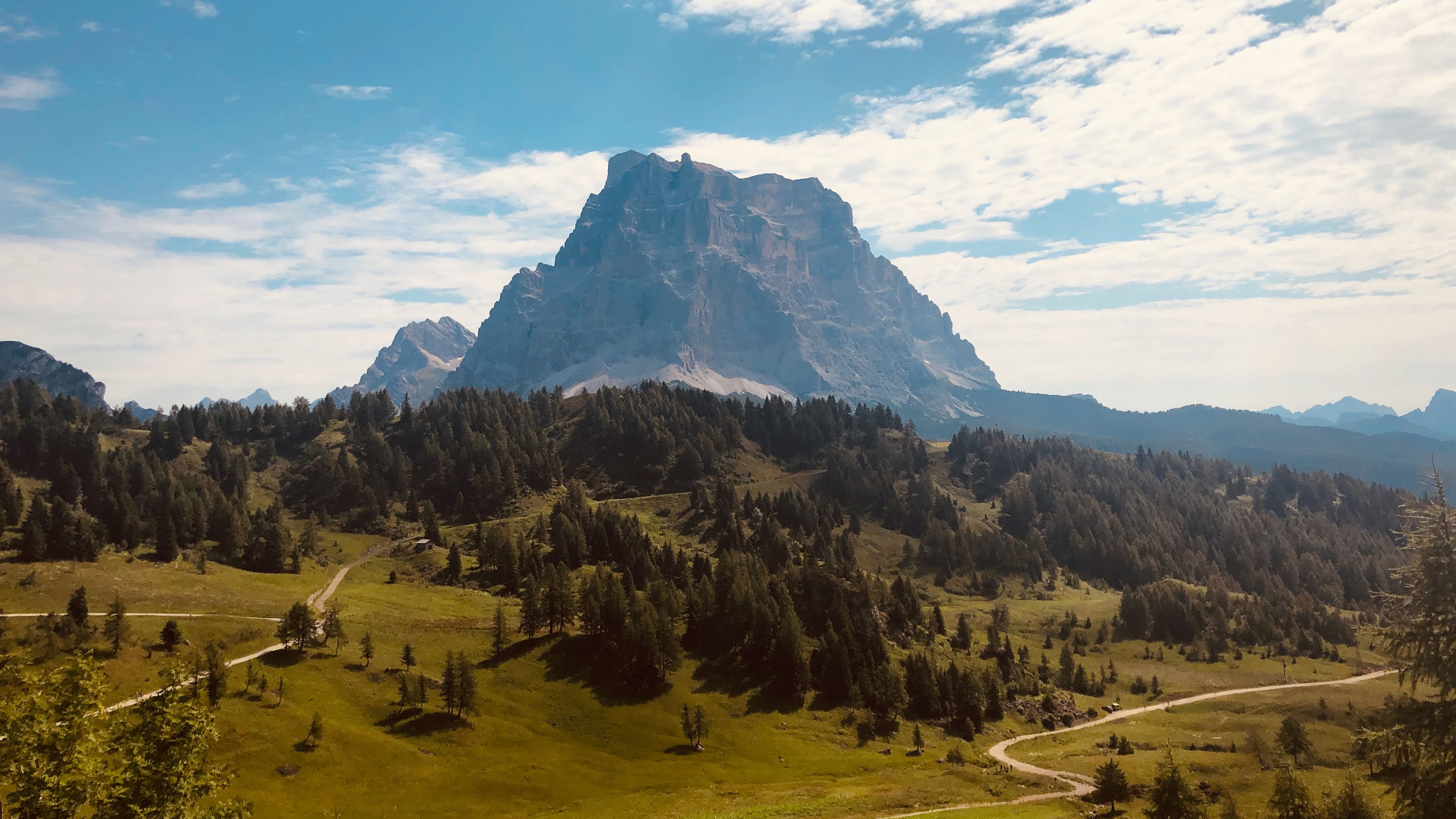
The Alta Via 1, or High Route 1, is a roughly 78 mile trail that runs from north to south through the Dolomites mountains in northern Italy. As the number 1 would suggest, there are many Alta Via's in the Dolomites, each increasing in difficulty as the number gets higher. 1 is the easiest of the routes, with 7 being the hardest, and 1 is the classic high route to do in the Dolomites.
It passes through some of the finest scenery in the Dolomites. And I must say, of the two thru-hikes I had been on so far, this one had the most captivating landscapes due to the varied shapes and colors of the mountains.
It took me roughly 10 days to finish it, but some people can do it in faster or shorter amounts of time. A typical day on the route involves several hours of walking, with ascents and descents of about 3,000 feet per day. As I've come to learn with any European trail, the best time to go is the summer, and that's exactly when I went: smack dab in the middle in July when it was at it's most busiest.
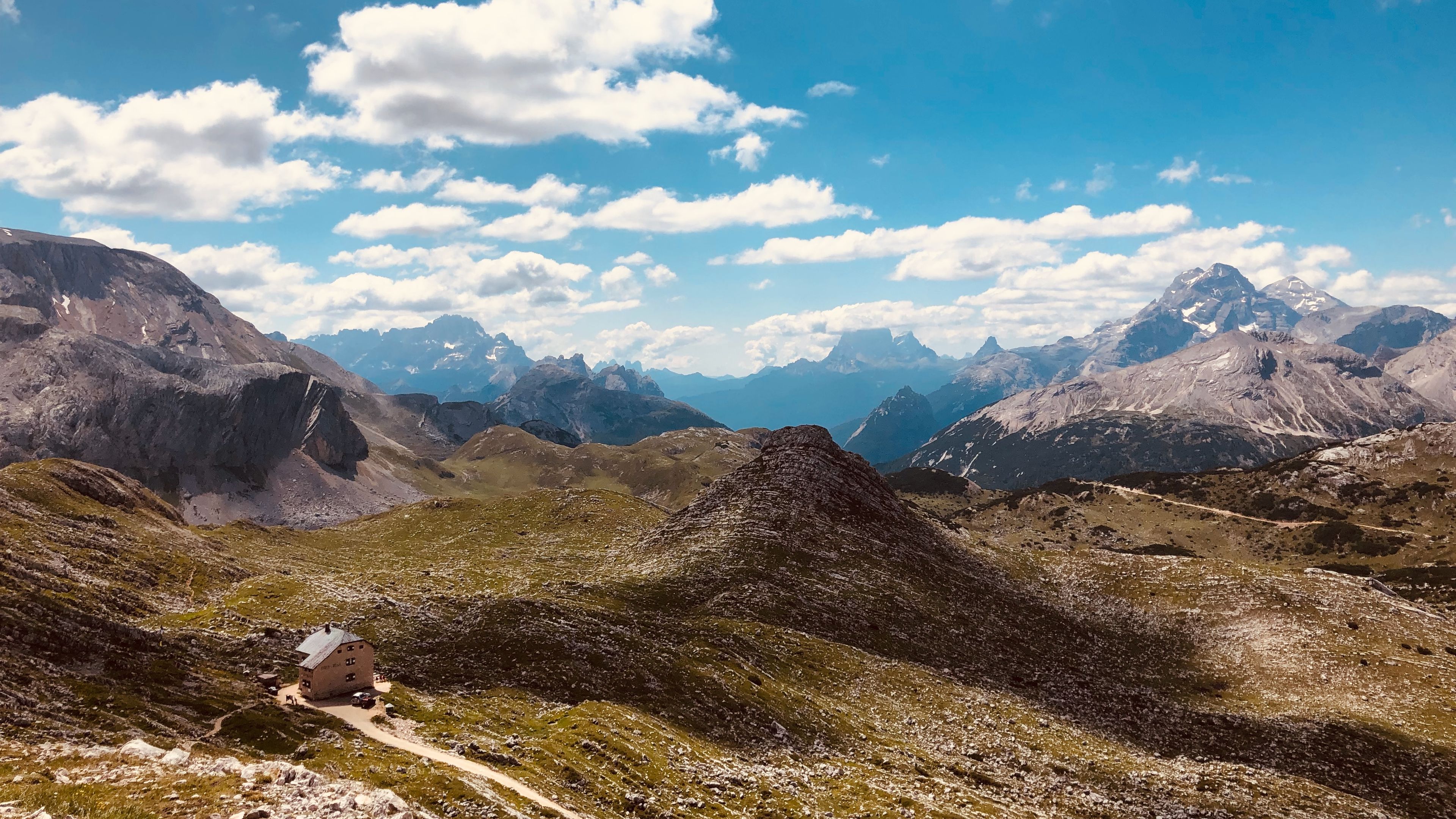
Where I spent each night
Much like Tour du Mont Blanc, the Alta Via 1 employs a series of mountain huts, or Rifugios, to stay at. They provide the same accomodations as the TMB: meals, bed to sleep in, and full bathrooms. Each one though is accessible by motor vehicle, so these particular mountain huts are much more luxurious. Truth be told, this thru-hike has had the best meals so far.
I think I actually gained weight on this trek!
As with any hut-to-hut hike I had to reserve where I would stay in advance. This meant that some days would be short and easy, with lots of down time, while others would be a longer and more difficult.
Stages
Every thru-hike is different, and while some may necesitate the need to follow the guidebook stages, others require the need to be flexible. For this thru-hike some of the stages are by-the-book, while others are a combination of two or more:
- Day 01
Braies to Rifugio Biella

View Route and read Trip ReportDistance 5.36 mi Elevation gain 4,304 ft Elevation loss 1,564 ft Time 5 h 2 m - Day 02
Rifugio Biella to Rifugio Lavarella

View Route and read Trip ReportDistance 8.19 mi Elevation gain 2,022 ft Elevation loss 2,951 ft Time 5 h 31 m - Day 03
Rifugio Lavarella to Rifugio Scotoni

View Route and read Trip ReportDistance 6.35 mi Elevation gain 1,856 ft Elevation loss 2,014 ft Time 5 h 0 m - Day 04
Rifugio Scotoni to Rifugio Averau

View Route and read Trip ReportDistance 9.71 mi Elevation gain 4,694 ft Elevation loss 3,336 ft Time 7 h 40 m - Day 05
Rifugio Averau to Rifugio Citta de Fume

View Route and read Trip ReportDistance 0.09 mi Elevation gain 1,599 ft Elevation loss 3,205 ft Time 6 h 40 m - Day 06
Rifugio Citta de Fume to Rifugio Tissi

View Route and read Trip ReportDistance 8.38 mi Elevation gain 3,124 ft Elevation loss 2,031 ft Time 7 h 40 m - Day 07
Rifugio Tissi to Rifugio Carestiato

View Route and read Trip ReportDistance 9.02 mi Elevation gain 2,532 ft Elevation loss 3,969 ft Time 6 h 0 m - Day 08
Rifugio Carestiato to Rifugio Pramperet

View Route and read Trip ReportDistance 8.18 mi Elevation gain 2,020 ft Elevation loss 1,955 ft Time 5 h 40 m - Day 09
Rifugio Pramperet to Rifugio Pian de Fontana

View Route and read Trip ReportDistance 3.77 mi Elevation gain 1,768 ft Elevation loss 2,470 ft Time 4 h 0 m - Day 10
Rifugio Pian de Fontana to Finito

View Route and read Trip ReportDistance 6.78 mi Elevation gain 1,190 ft Elevation loss 5,095 ft Time 5 h 0 m
While this trail is definitely a popular one, it also felt much more public given the ease of access to the Rifugios, and the trail itself, with multiple points of entry along it. This trail did not feel "as removed" from the world as the TMB.
This thru-hike had the most diverse landscapes I have seen up to this point, and it had the best meals you could ask for. Combine that with having a good friend as my travelling companion and I couldn't go wrong. We also befriened a couple of pairs of hikers who had the same schedule as us, and walked with them for nearly the whole way.