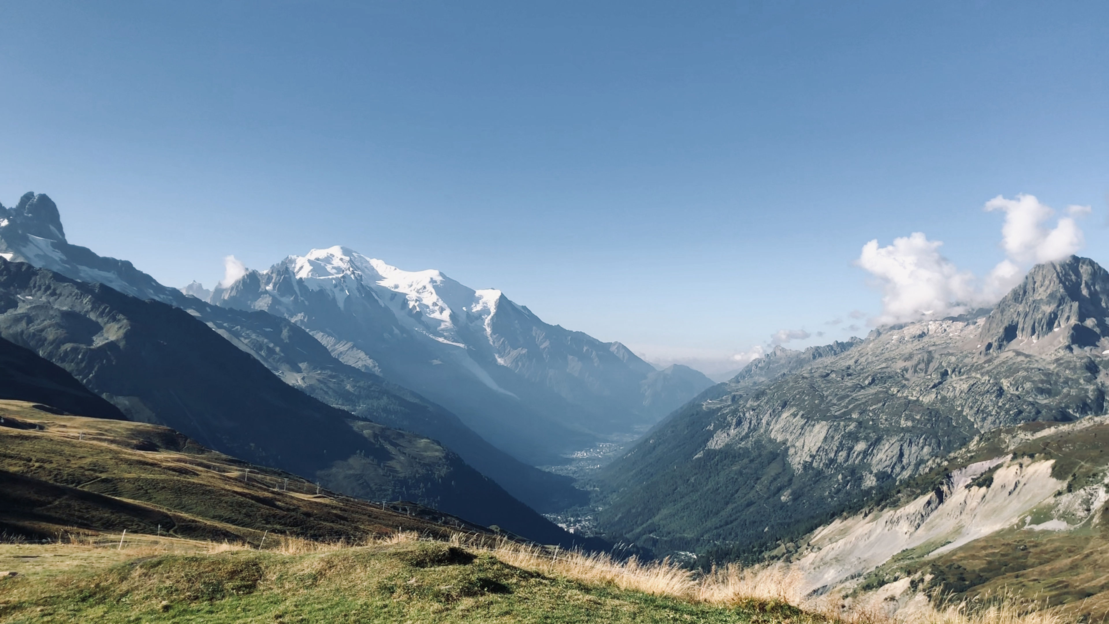
Completing the Tour du Mont Blanc
Long before I ever set foot on the Camino in Spain, I had already locked my sights on another epic thru-hike in Europe, determined to take on yet another unforgettable adventure.
| Distance | 104.98 mi |
|---|---|
| Elevation gain | 36,877 ft |
| Elevation loss | 36,701 ft |
| Time | 12 days |
Way before I set foot on the Camino in Spain, I had already committed to doing a thru-hike called the Tour du Mont Blanc. The Camino was my first time in Europe, let alone my first thru-hike/backpacking trip ever, and yet I had determined that I would like it so much that I would want to do another not two months later. Sounds crazy, right?
Luckily, I was enamored with thru-hiking thanks to a great experience on the Camino. So, even though this trip was two months away, I was already counting down the days until I returned to Europe.
What is the Tour du Mont Blanc
The Tour du Mont Blanc, or TMB, is a hiking route that encircles the Mont Blanc mountain in the Alpes, passing through three different countries: France, Italy and Switzerland. It's around 100 miles long, with a lot of elevation gain/loss. It's also considered a classic long-distance hiking trail.
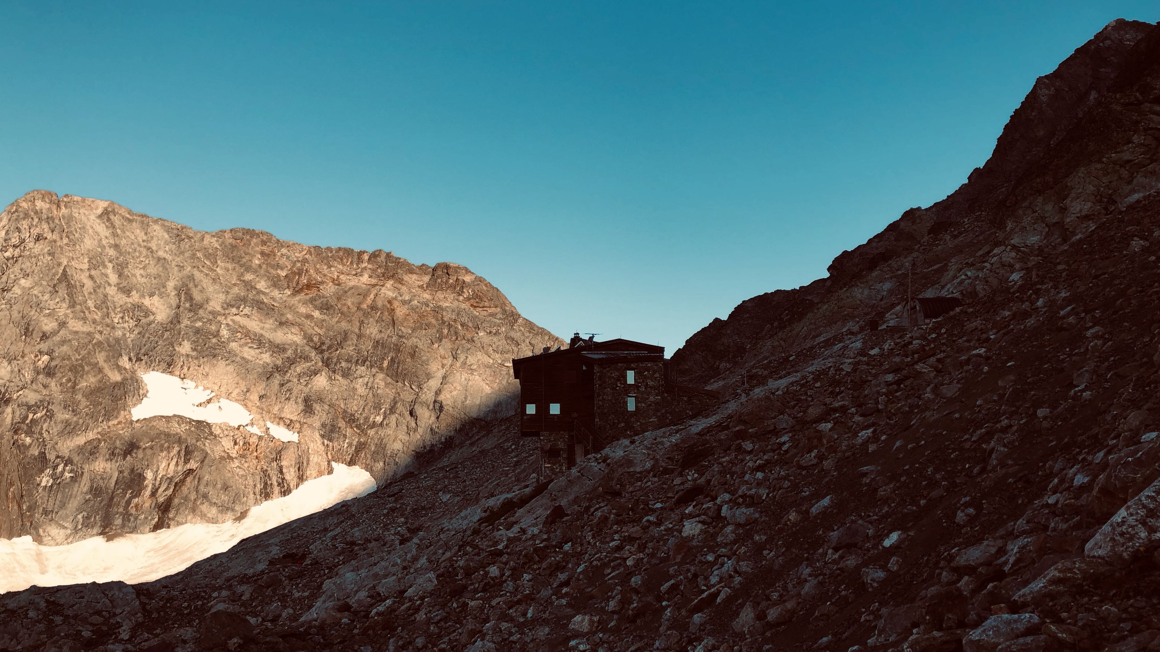
Where I spent each night
Along the route there were places called Refuges in the mountains where I spent the night. Amenities varied at each place, but they usually included a bed with blankets, a full bathroom setup, and meals that can be ordered a-la-carte. I paid full price for my bookings which meant breakfast and dinner were included.
All of them had to be purchased in advance in order to guarantee a place to stay.
What I brought
I used the same gear from the Camino, and it worked out pretty well. Here's a brief list of some of the items that I had to bring in order to make this a successful hike:
- Sleeping bag liner
- Power bank
- Pillow
- Refuge outfit
- Hut slippers
- Water filter
- Headlamp
- Trekking poles
- Entertainment
The refuges won't let you stay there without a sleeping bag liner (in order to help prevent the spread of bed bugs), and slippers (i.e. some pair of footwear other than the shoes you've been hiking in all day). Entertainment is important because you could have a lot of free time on your hands. I brought a book to read, and some playing cards.
I wasn't sure what I would be able to do, physically, so I bought a guidebook and used that to help me plan my trip. Availability also had an influence since I booked my stays late in the booking season. Because of the variety and locations of places to stay, I broke the route down into the stages below.
Stages
Every thru-hike is different, and while some may necesitate the need to follow the guidebook stages, others require the need to be flexible. For this thru-hike some of the stages are by-the-book, while others are a combination of two or more:
- Day 01
Les Houches to Auberge le Truc

View Route and read Trip ReportDistance 9.23 mi Elevation gain 4,669 ft Elevation loss 2,333 ft Time 7 h 30 m - Day 02
Auberge le Truc to Refuge de La Croix du Bonhomme

View Route and read Trip ReportDistance 10.52 mi Elevation gain 4,395 ft Elevation loss 2,027 ft Time 7 h 0 m - Day 03
Refuge de La Croix du Bonhomme to Refuge Robert Blanc

View Route and read Trip ReportDistance 7.87 mi Elevation gain 3,916 ft Elevation loss 2,900 ft Time 7 h 45 m - Day 04
Refuge Robert Blanc to Maison Veille

View Route and read Trip ReportDistance 11.1 mi Elevation gain 2,303 ft Elevation loss 4,922 ft Time 7 h 15 m - Day 05
Maison Veille to Rifugio Bonatti

View Route and read Trip ReportDistance 10.36 mi Elevation gain 3,523 ft Elevation loss 3,308 ft Time 7 h 10 m - Day 06
Rifugio Bonatti to L'Auberge Maya Joie

View Route and read Trip ReportDistance 11.9 mi Elevation gain 2,907 ft Elevation loss 4,225 ft Time 7 h 20 m - Day 07
L'Auberge Maya Joie to Gite Bon Abri

View Route and read Trip ReportDistance 10.22 mi Elevation gain 1,707 ft Elevation loss 2,226 ft Time 6 h 45 m - Day 08
Gite Bon Abri to Refuge le Peuty

View Route and read Trip ReportDistance 8.74 mi Elevation gain 4,044 ft Elevation loss 4,415 ft Time 8 h 20 m - Day 09
Refuge le Peuty to Auberge la Boerne

View Route and read Trip ReportDistance 8.79 mi Elevation gain 3,723 ft Elevation loss 3,316 ft Time 7 h 10 m - Day 10
Auberge la Boerne to Refuge de lo Flegere

View Route and read Trip ReportDistance 5.1 mi Elevation gain 3,136 ft Elevation loss 1,636 ft Time 6 h 10 m - Day 11
Refuge de lo Flegere to Refuge de Bellechat

View Route and read Trip ReportDistance 6.6 mi Elevation gain 2,412 ft Elevation loss 1,568 ft Time 4 h 0 m - Day 12
Refuge de Bellechat to Les Houches

View Route and read Trip ReportDistance 4.55 mi Elevation gain 142 ft Elevation loss 3,825 ft Time 4 h 0 m
The TMB was said to be one of the most popular long-distance walks in Europe, and they weren't kidding. There was a good amount of people on it when I went, and I met some great people. Backpackers/thru-hikers are definitely my kind of people. It's an awesome feeling to be part of a larger group that is all working towards the same goal.
This thru-hike, just like the Camino, did not disapoint. The sights are amazing, and the effort I put in during each day made every sight and sound worth it.
I can't wait to do this one again.