- thru-hike
- south america
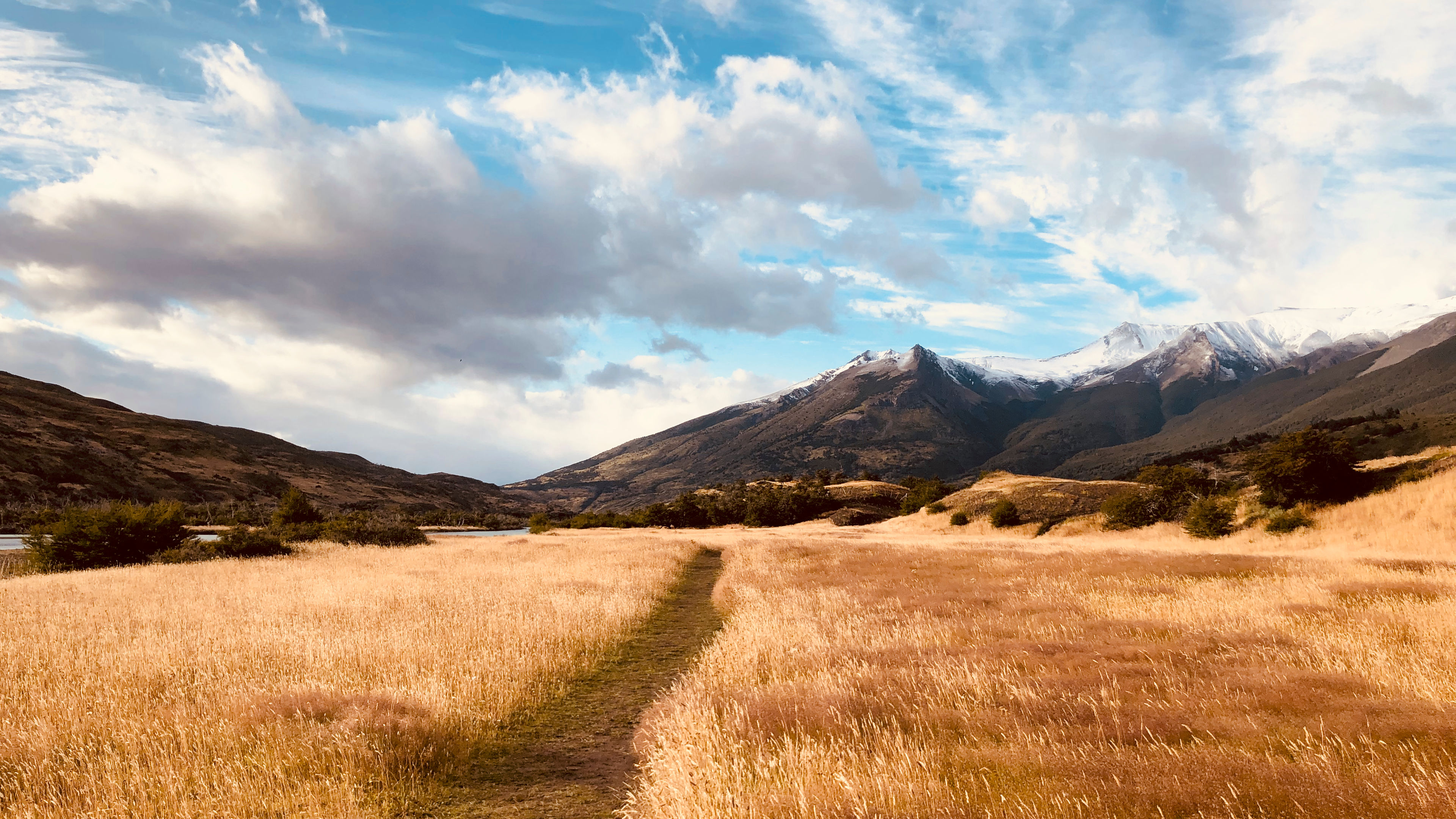
- patagonia
- Categories for the post
Hiking The Torres del Paine "O" Circuit in Patagonia, Chile
After my first trip to Patagonia in 2016, I couldn't shake the longing to return one day and take on the epic long-distance hike that winds through the heart of the national park.
| Distance | 71.94 mi |
|---|---|
| Elevation gain | 13,198 ft |
| Elevation loss | 13,188 ft |
| Time | 8 days |
Ever since my trip to Patagonia in 2016 I have dreamed about returning to do the long distance hike around the national park known as the "O" Circuit. Because it was my first introduction to the world of backpacking, it always held a special place in my heart, and who doesn't like being able to go someplace nostalgic?
I went at the end of February in 2020, just as COVID-19 was beginning to make headlines. And you might also be thinking "end of February, isn't it snowing?", and no it was not since in the southern hemisphere our winter in the north is their summer, albiet I went towards the end of their summer.
What is the "O" Circuit
There are two trekking routes (or circuits) in Torres del Paine National Park: the "W" and the "O". Both routes get their names from each trail’s layout. The "O" is a route that runs the entire perimeter of the park, and ends at the same place it starts. Whereas the "W" starts at the left-hand side of the park, bumps into the middle of it at the Towers, and then ends at the right-hand side of the park.
A highlight of the "O" circuit is Grey's Glacier. And the circuit itself attracts hundreds of travelers from different corners of the planet each year. The route is roughly 85 miles in length and it took me 8 days to complete it. It's a longer distance than the "W" and therefore feels more intimate with nature because it has fewer hikers on it, but still plenty to make friends!
Where I spent each night
This trek was different from the others I had done up until this point due to the primary mode of accomodation being a tent! Yes some beds were available in dormitories at each daily stopping point, but they were much more expensive. I had never done a backpacking trip before that required a tent, so I bought one that was rated for strong winds and heavy rain (common things in Patagonia), as well as one that utilized my trekking poles in order to hold it up so that I could save on weight.
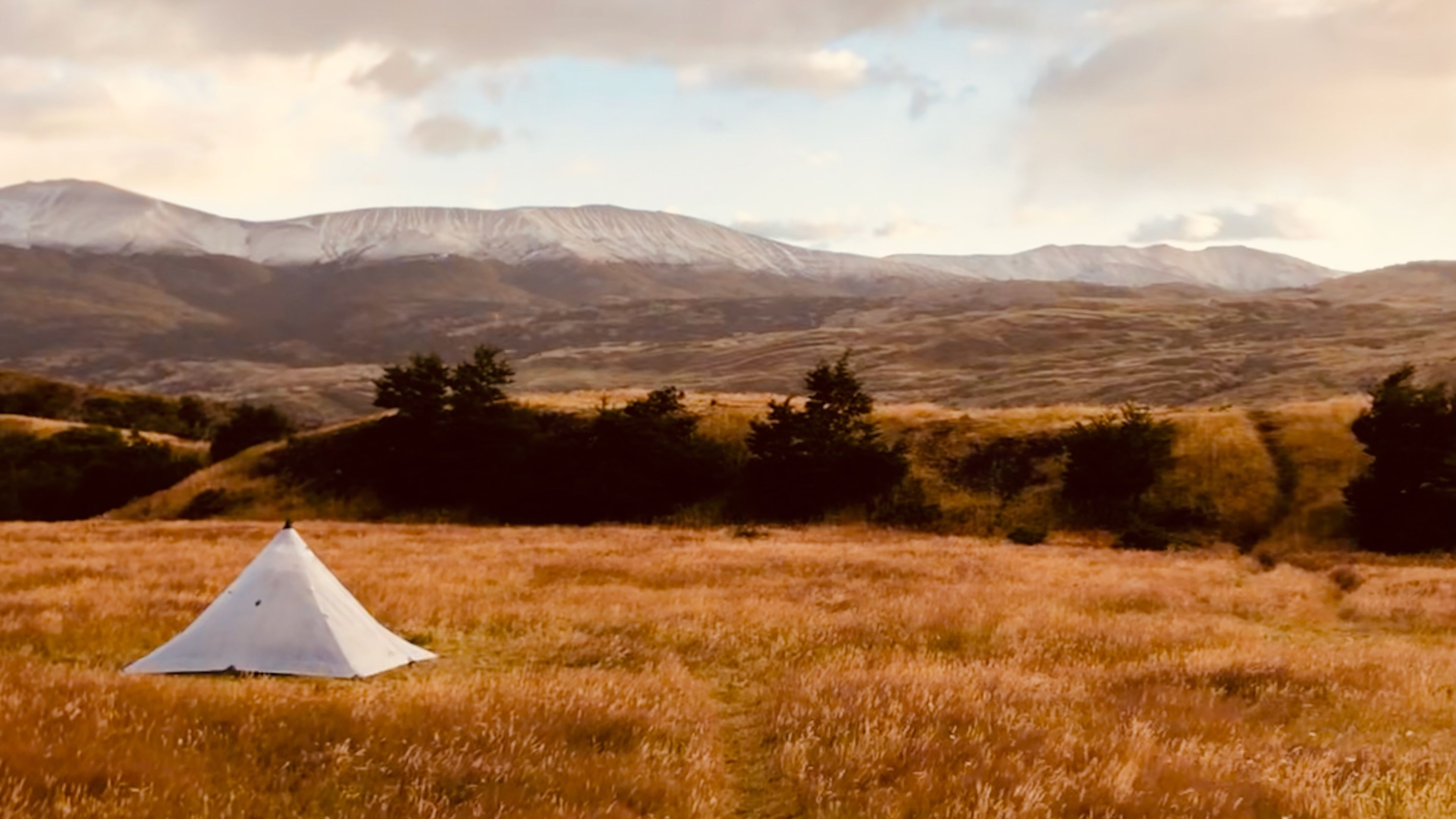
Each stopping point had a Refugio, provided a kitchen to cook in, and meals for those who were staying in the dormitories. on this particular trek I decided to bring all of my food with me (a common thing on the "O"). Combine this with all of the camping gear and my bag must have weird close to 35 pounds at the start!
What I brought
In addition to having a waterproof and strong tent, I also needed to bring a thick and comfortable sleeping pad as well as the same warm sleeping bag that I had brought with me on the Annapurna Circuit. Always bring a water filter, and a large power bank is a must due to the remoteness of these Refugios. While it never rained during the day, a good rain jacket is also a must.
- A strong tent
- Warm sleeping bag
- Thick sleeping pad
- Large power bank
- Pillow
- Water filter
- Trekking poles
- Entertainment
- Warm fleece
- Down jacket
- Good rain jacket
Due to the limited number of places to stay on this trek (there were only 9), I had to book everything in advance which meant locking in how far I could go each day. Not something I'm a fan of.
Stages
Every thru-hike is different, and while some may necesitate the need to follow the guidebook stages, others require the need to be flexible. For this thru-hike some of the stages are by-the-book, while others are a combination of two or more:
- Day 01
Welcome Center to Refugio Seron

View Route and read Trip ReportDistance 8.12 mi Elevation gain 895 ft Elevation loss 779 ft Time 3 h 40 m - Day 02
Refugio Seron to Refugio Dickson

View Route and read Trip ReportDistance 10.98 mi Elevation gain 1,036 ft Elevation loss 920 ft Time 4 h 10 m - Day 03
Refugio Dickson to Refugio Perros

View Route and read Trip ReportDistance 7.03 mi Elevation gain 1,429 ft Elevation loss 268 ft Time 4 h 30 m - Day 04
Refugio Perros to Refugio Grey

View Route and read Trip ReportDistance 8.6 mi Elevation gain 2,395 ft Elevation loss 3,976 ft Time 5 h 15 m - Day 05
Refugio Grey to Refugio Paine Grande

View Route and read Trip ReportDistance 6.54 mi Elevation gain 906 ft Elevation loss 1,037 ft Time 3 h 45 m - Day 06
Refugio Paine Grande to Refugio Frances

View Route and read Trip ReportDistance 12.35 mi Elevation gain 2,621 ft Elevation loss 2,201 ft Time 6 h 0 m - Day 07
Refugio Frances to Refugio Chileno

View Route and read Trip ReportDistance 9.51 mi Elevation gain 2,064 ft Elevation loss 1,225 ft Time 6 h 15 m - Day 08
Refugio Chileno to Welcome Center

View Route and read Trip ReportDistance 8.81 mi Elevation gain 1,852 ft Elevation loss 2,782 ft Time 9 h 20 m
I had a great time on this trip, and it was just the right amount of rustic and modern comforts mixed together. The tent performed very well, although one of my trekking poles did bend in some hurricane-force winds at Paine Grande (everyone had a rough sleepless night that day, along with some sort of tent damange).
With another type of trek under my belt, I was ready to plan the next hike, but that would have to wait another two years because of COVID-19, and lockdown.