Refuge d'Usciolu to Refuge d'Asinau
The morning was spent walking through an unexpectedly lovely, and lush, plateau, full of green as far as the eye could see. But the trail turns towards the ascent once more, before dropping down to the Refuge.
The wind howled all night, and the rain didn't let up. I couldn't stretch out fully in the tent, so I had to lay at an angle and/or curl up for most of the night. These tents are apparently daylight-proof though; I opened the flap to a nice sun-filled morning, nothing like last night.
| Distance | 13.88 mi |
|---|---|
| Elevation gain | 3,809 ft |
| Elevation loss | 4,453 ft |
| Time | 7 h 2 m |
The trail started off by going up some mountain ridges with minor scrambling here and there. These ridges and their highs and lows looked deceptively small from far away, and seemed like they would be easy to do, but not so once I got to them. I got lost a couple of times, simply becaues the markers were difficult to find in certain areas.
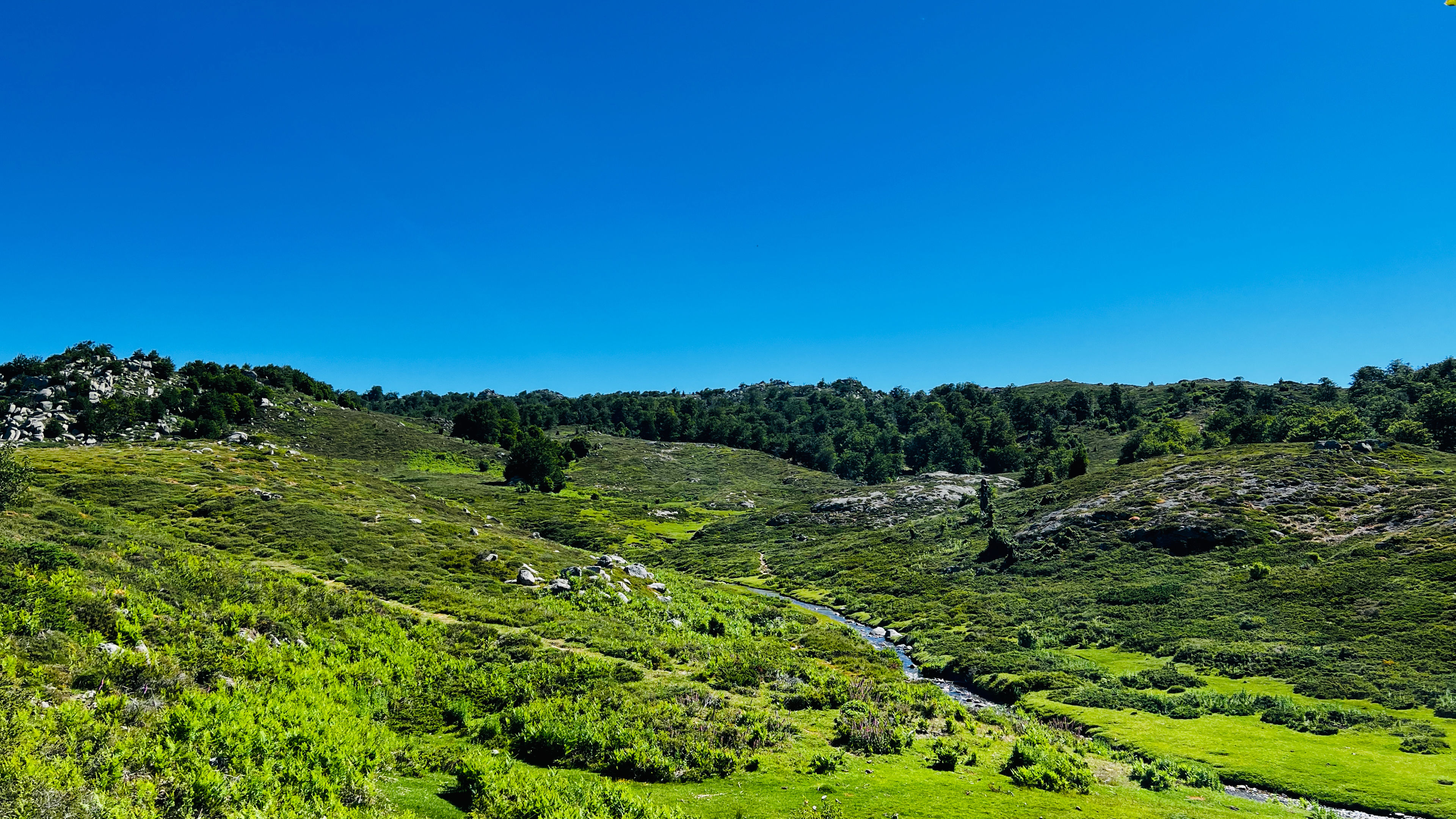
Once the ridge portion was done it was time to go down a muddy series of switchbacks towards the woods below. I was in good spirits as I raced down. After that the trail started to level out, and go through a small strand of trees. These trees gave way to gently rolling green hills dotted with large boulders, and I could see far into the distance: this would be the trail for a good long while today, which was nice. I was making great time as well. They weren't kidding when they said the southern portion was easier.
Here and there large rivers and streams cut across the path, with some watery crossings along the way. These were some of the greenest areas of the trail that I had seen so far on this trip. After the river portion was done it was time to head through local farmers fields and past some other non-refuge places that people could stay at. I could have stopped for breakfast, but it didn't look like they were open for non-guest visitors just yet, so I kept going.
The trail went up and around a series of twists and turns through lush vegetation and I came to an abandoned house with plant-life of all colors around it. And not a trail marker in sight. It took me and one other stranger a few random attempts of searching in multiple directions before we found the markers. Shortly after resuming the trail I came upon a refuge that I had orinally planned on staying at, and I'm glad I didn't. It was so bare and plain looking. I did stop though to rest and snack on the food I bought the previous night.
The trail turned into a dirt and gravel road for a while. Eventually it branched off from the road and went through some very green land with a small river running through it. After a short while I came upon another place to eat at, and I decided to try and get some lunch here. Unfortunately I struck out: the kitchen wasn't open yet and wouldn't be for another hour or so. Disheartened I picked up my backpack and got back on trail.
For the remainder of the afternoon the trail would go up at a steady rate, mostly along a road again before branching off and going back into nature. The landscape was very hilly and dotted with small boulders. It was a lovely sight. I was making amazing time doing two stages again.
I didn't think the southern portion had any elevation points as high as the north, but here was one of them. It was nearly 6,500 feet above sea-level, and was up in the clouds. The ascent up to the top wasn't too bad though, and I couldn't see the refuge from way up here, but I'm sure it was down there somewhere. The descent was one of the worst, especially after doing a double-stage day. My knees were killing me. I made it to the refuge 1 hour earlier than the official time the signs along the way said it would take, not bad.
Dinner here was delicious, and my stuff stayed dry overnight even though some clouds had decided to move in during dinner. There wasn't much to do up here, or many communal places to sit, and the temps were dropping fast, so I spent most of the night reading in my tent.